Some more mapping questions

Basic movements,control/tools, structure,weather/water, presentation lures, lake types, mapping, mental aspects
Post Reply
DRH2O

Some more mapping questions

Post by DRH2O »

Hello Gents! How goes the fishing?

So I've spent a good portion of the summer doing my best to remember and follow spoonplugging guidelines; to take the principles as I understand them and apply them in practice. The kicker is that I've been trying to apply them to fishing out of my kayak, which poses a particular set of challenges but gives me enormous satisfaction. I'm keeping a record of special difficulties and my adaptations that I hope to outline after the season in a thread of it's own.

It hasn't always been as straight-forward as it comes off in the instructional material and frankly there have been days and lakes that just plain beat me and had me back pitching a jig at shoreline cover. But there were other days too. Days that hinted of something coming together into a larger picture. Days where asking the how's and why's about a fish caught from the shallows led to more and larger fish coming from a nearby breakline in deeper water. Days where every other angler answered my question with, "not much happening today" - but I was catching fish. Good days, because of the guidelines.

Mapping/interpretation is really where I feel like I'm still just a toddler trying to learn to walk. I can discover structure situations more or less ok but fine-tuning my mental map of the features and breaks by relying on my lures and markers instead of my depth finder is a struggle.

Maybe my expectation of how the markers should be used is wrong. Or maybe the way I use them should be different based on the size of the structures, which are often relatively small since I frequently fish on smaller lakes to accommodate the kayak - some as small as 50 acres.

Let me lay out an example and maybe you all might have some good pointers for me.

let's say I discover an underwater bar that extends out from shore. I want to discover the spot where the crown starts to break into deeper water at the point furthest from shore. In my head, I want to mark that spot with a buoy marker just a few feet either inside or outside the actual break. If I try to throw markers trolling I'll end up with markers on both sides but never on it. If I'm running, say, 50' of line and throw a marker as soon as I start bumping the bar then I have one marker 50' to one side. If I then turn around and come at it from the other direction and do the same then I have two markers 100' or so apart and I have to gauge that the bar is in the center. Unless I'm hitting a bar that is 100' across, in which case I'll have two markers on the same spot and I have to gauge that the bar extends 50' in both directions - meaning I need to move out further to get to the contact point I'm looking for.

It just seems a LOT easier to me to just paddle around watching my depth finder and trying to drop a marker right on the spot once I've established with the lure that there is a structure situation below. Easier isn't always better though, I know, and every time I resort to this (often) I feel like I'm cheating myself out of all that there really is to learn.

Are you guys looking to precisely mark the spot on a spot or are you throwing markers just to keep you in the general area while you make shore-line sightings and build a mental map? (shore line sightings - another area I need work. Line up the tall tree in the second clump on top of the first bridge piling during the third pass? Or was it the third tree in the first cluster to the second bridge piling on the third pass? Sorry... That's probably another thread huh? :roll: )
User avatar
Steve Craig
JB2
Posts: 1968
Joined: Tue Feb 05, 2008 3:22 pm
Location: Arizona

Re: Some more mapping questions

Post by Steve Craig »

DRH20,
One of the fastest ways to "map" a structure and to get a general idea (picture) of what is down there is to simply use your depth finder.
Leave the lures in the boat.
If you find, lets say a bar, the first thing you should do is run off it and find your deep water. Remember, deep water is the home of the fish.
Everything starts here.
Everyone does it a little differently, but I prefer to first see if I have deep water near by the bar.
As i am running out on it, I will drop a marker at the 10 foot spot as a reference point.
Lets say I have a 30 foot area on one side of the bar and 32 feet on the other, but both close to the tip of the bar.
I then motor from that 32 foot spot back towards my marker all the while looking for any breaklines.
Lets say I find a breakline at 27, 17, and 12 feet, and the bar crowns out at 6.
I drop a marker on the 27 and one on the 17 and i use my 10 foot marker as a reference for the 12 foot breakline.
I then motor completely around the bar on the 12 foot breakline looking for any "change" in direction of that breakline. I then do the same thing on the 17 and again on the 27.
It is uncanny how often a finger found on the 12 will also show up on both the 17 and 27. Not all the time, but more often than not.
Markers will be thrown on each finger.
You now have a "picture" of what your bar looks like. If that 27 foot spot breaks into that 32 foot deep hole, we must assume that that is the "contact point" (at this time) as it breaks into the deepest water in the area,deepest water available, or it could even be the deepest water in the entire lake.
Now draw a map on paper right then and there!

This has only taken us no more than a few minutes to do when we are using the right equipment.(boat, motor, depth finder). For me usually 5 to 15 minutes. depending on how big the structure is and how many fingers etc.

Only now are you ready to "fish it".
Now we go back to the shallows and run the lures from shallow to deep.
If no fish are caught on the troll, then we cast it to check out the slower speeds.
If no fish are caught, then I will usually go and find another structure to map and do it all over again there.
But, coming back and "check" this structure.

Our "interpretation" always starts in the deep and goes towards the shallows. Our " fishing" starts in the shallows and goes towards the deep.

You are handicapped from the start by using a Kayak. It will take you longer. You will not be able to get a consistent speed for seeing those breaklines on your finder, especially if they are subtle.
And you will not be able to check your faster speeds on the troll. I doubt you can get that Kayak running 7 to 10 mph on the troll for long periods of time to make the fish "take" when it is hot out.

Buck gave us guidelines for a reason. One of them is to use the proper tools. When we leave out anything he said, our success will be affected in a negative way.
Put a little 2 horse on that thing or get you a good 12 foot Jon boat and 5 horse motor and get out there and start mapping.
FWIW
Religion is a guy in church, thinking about fishing.
Relationship is a guy out fishing, thinking about God!
User avatar
John Bales
JB2
Posts: 2521
Joined: Sat Feb 12, 2005 8:51 pm

Re: Some more mapping questions

Post by John Bales »

Immediately after reading your post, my thoughts were that this guy is putting in the effort and his choice of tools are really costing him in the learning department. Everything that Steve said is the truth and the way to go about finding structure and mapping it. I was waiting for him to tell you the truth about your tools and he finally did in his last two paragraphs. Steve is much more nice than I am and said it as nice as he could. Your love for the little rig is holding you back and you should do your fishing out of anything that will get the job done. Don't lose hope, just get you a different rig. John
User avatar
ltharley
100 series
Posts: 327
Joined: Mon Jul 29, 2013 9:47 pm
Location: Milwaukee, WI

Re: Some more mapping questions

Post by ltharley »

DRH,

Don Dickson, one of Buck's top students, put out a few great videos some years ago. They are still available in VHS on ebay from time to time. The one that outlines the mapping and interpreting process similar to what Steve noted is really helpful. The tape is on water mapping of structure ( I believe Chase Klinesteker is a student in the tape). Don outlines using your flasher (sonar) to identify the primary / secondary breaklines and then to follow each around the entire structure, be it a bar or hump, dropping a marker on any notable features (turns, points, etc.). He then takes sounding off of each feature in an effort to find the longest, narrowest, sharpest break, to the deepest water. This should be the contact point.

What I do is similar, but because my Humminbird has the ability to lay down a recorded track, I do a complete outline of the structure (or at least the portion I am interested in). I start by finding the shallowest breakline, say 8' for an example. I then follow that breakline dropping a marker every 50' or so. Then I go back, moving from marker to marker while recording the track. If there is a significant breakline at a deeper depth, I do the same thing. If I discover any spots that would indicate a possible contact point, I drop a marker there and lay down a waypoint.Then I begin my fishing. I let my lures identify any features not noted during the above mapping.

Though Buck outlines a process using your lures, I am sure he would take full advantage of today's technologies.

Hope this helps.

Dennis
User avatar
John Bales
JB2
Posts: 2521
Joined: Sat Feb 12, 2005 8:51 pm

Re: Some more mapping questions

Post by John Bales »

The poor guy is trying this out of a little canoe. His speed and control is not fast enough to interpret much of anything. What should take minutes to interpret what is there is not happening for him. Forget the little boat, spend the money on something that will do for him what he is looking for and spend the rest of your life having a great time catching fish and sharing knowledge. I hope you can make the change. This is for you. John
DRH2O

Re: Some more mapping questions

Post by DRH2O »

Thanks for the input guys, it does help clear up some of my confusion about the process.

Also I appreciate the directness here regarding my choice of tools and their limitations. I understand that these comments are being made in an effort to get me the most reward for my effort.

For what it's worth I actually have picked up a boat that I hope to have ready for the water by next year and that I will most assuredly outfit with all of the recommended spoonplugging tools. This, so I can take family and friends out and put them on fish.

That said, if we're just talking about personal satisfaction, I have to say that if I'm not taking others out, and it's just me, that most of the time it will still be in my yak. It really does give me great satisfaction. It is limiting in certain situations I admit (although not as much as you might expect) and there are most definitely trade-offs.

From the start, however, my goal has been to discover just how effectively I can apply the guidelines to my yak fishing and see tangible results. I understand my approach isn't going to give me the results that many of you veterans get, and that to some extent it may even be frowned upon a bit from the purist perspective simply because I'm doing it wrong. I'm not trying to upset the applecart here though - I'm just a guy intent on chasing after his own form of satisfaction.

Thanks again for the feedback and clarification
~Denny
User avatar
John Bales
JB2
Posts: 2521
Joined: Sat Feb 12, 2005 8:51 pm

Re: Some more mapping questions

Post by John Bales »

Denny, You sound like you are putting in more effort than a lot of our spoonpluggers do. And hats off to you for already working on a different boat. I have been known to be a little rough on the new guys and some don't come back. I will also be the first one to give credit when it is due. You have already found out that you can get any information you will ever need from this forum. The guys want you to do well and hear about your progress or the lack of it. We have all been through the beginning stages and have all had our problems. You will work through them and just get better. Mr. Perry was a great man and spoonplugging is awesome. John
User avatar
ltharley
100 series
Posts: 327
Joined: Mon Jul 29, 2013 9:47 pm
Location: Milwaukee, WI

Re: Some more mapping questions

Post by ltharley »

Hey Denny,

I find the Yak thing pretty intriguing. Have considered purchasing one for use on small lakes that are inaccessible with my boat. Have also been watching Yak guys in the Milwaukee Harbor catching some big King Salmon. What a blast. Those pigs drag their Yak around. Too fun.

Anyway, I'm sure if you do your mapping as suggested you will find using your rig a lot easier. Enjoy.

Dennis
User avatar
Steve Craig
JB2
Posts: 1968
Joined: Tue Feb 05, 2008 3:22 pm
Location: Arizona

Re: Some more mapping questions

Post by Steve Craig »

Denny,
Again, no offense intended.
You asked questions, we answered. Believe me, we are only trying to help you on your way and to get you there "fishing in the right place, in the right manner, AND with the right equipment" to achieve success.
"Knowledge is the key to success, and success is the key to satisfaction".

You said....." I'm just a guy intent on chasing after his own form of satisfaction."

Fair enough. I can relate. I wish you all the luck and best wishes on your fishing endeavors.
Steve
Religion is a guy in church, thinking about fishing.
Relationship is a guy out fishing, thinking about God!
User avatar
ltharley
100 series
Posts: 327
Joined: Mon Jul 29, 2013 9:47 pm
Location: Milwaukee, WI

Re: Some more mapping questions

Post by ltharley »

And a Happy Birthday to you Denny. Buy yourself something pretty.
DRH2O

Re: Some more mapping questions

Post by DRH2O »

ltharley wrote:And a Happy Birthday to you Denny. Buy yourself something pretty.
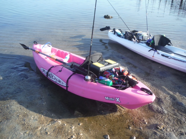
Done!

Image

Kidding. I'm kidding... :mrgreen:
User avatar
jwt
800 series
Posts: 666
Joined: Sun Mar 06, 2005 11:21 am

Re: Some more mapping questions

Post by jwt »

A belated Happy Birthday to you Denny. Where do you put the kitchen sink?
User avatar
joseph radunz
200 series
Posts: 148
Joined: Sun Feb 13, 2005 2:39 pm
Location: buffalo

Re: Some more mapping questions

Post by joseph radunz »

Dr. Dennis,
Just my 2 cents here and I know this thread is old but I'm just catching up. You said you bought a boat for when you have friends and family with you, so USE THAT TO MAP. Hit your favorite lakes with the boat first and do all your mapping and get your rifle sites out of the boat. From there on out you'll know your trolling passes and anchor positions so you can then proceed to take the "Yak" out after and hit the same tubs. I thought I read somewhere that you can hit a contact point with the Titanic if you have the right line sights. If your gig is the yak then by all means use it. But, it will be extremely difficult to figure anything out if you are solely using that. However, if you use the boat in conjunction with the yak then your satisfaction can be met. During the warmer months you probably will still have trouble trying to troll in the yak as your speed will never be close enough to trigger a strike, but for the rest of the year your may have a shot. FIND YOUR ANCHOR POSITIONS IN THE BOAT. Then easy enough plop down with the yak and load it up! Good Luck Brother!
JR
Post Reply