Lake of the week
Lake of the week
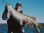
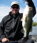
I thought we could use a lake of the week to get things going again. Here is a 465 acre natural lake. It is stocked nearly every year with Muskies. It also has a decent Bass population. It is fall. Unfortunately trolling is not allowed. Where and how are we going to target these fish to make a catch.
- Attachments
-
- Lake of the week.pdf
- (194.22 KiB) Downloaded 379 times
Re: Lake of the week
Bill,
Excellent choice. My process would be to obtain any additional maps, internet information, etc. to prepare. When I arrive at the lake I will do a quick mapping of the lake without lures to account for everything the map doesn't show and identify breaklines. This is probably all a given but worth mentioning. If the lake is very large I'll do sections at a time but in this case it will be quick.
Next step for me depends on what I'm targeting. It's a different approach for bass vs. musky personally. Maybe that is a separate discussion.
If we're just focusing on the possible structure situations based on your map, here goes.
- The point in the top left of the map (technically the west end of the lake). Map doesn't show the shoreline point extending into the water but I'm betting it does so I'm checking/fishing that area.
- The hump top right (north end).
- On bottom right of map (south east) it looks like the deep water may swing in close to shore with possibly two points coming off the shore. Needs to be checked.
- On the right of the map (S) it looks like a small point at 18'. Checking that area.
- Top of map (NW) steep shoreline - I'm taking a look to see if there's anything interesting.
For musky, I'm trolling every breakline top to bottom. I'm anchored and casting key spots mentioned above if they look good on the water and any others the map doesn't show. If I feel like it I may additionally use live bait and hook up a large sucker and set to a particular breakline depth and vertical jig different areas while Mr. Sucker gets a soak.
For bass late in season I'm using a casting approach, mainly a blade bait. I'll let the man pipe in on it if he wants since I'm just a novice. However I'm much less interested in looking for bass in a largely populated musky lake. I'd prefer to go where the muskies ain't for bass.

Re: Lake of the week
First thing I did was look for an up-to-date map. That DNR map is from June 1965 and hydrographic mapping has made a few improvements in the past 48 years. The Navionics map looks like a better representation.
Given: "Class A" musky lake, ergo motor trolling is prohibited. Bill said it's fall(I'm assuming Nov from the date of the posting) so the water has probably cleared and might be close to ice-up. The weedline in the old DNR map appeared to be about 3' in 1965. What is it now?
To me, the first order of business is find the depth of the weedline and the depth of the first breakline, and then SONAR "troll" the lake making note of potential "fishing" water and go from there. Right off the bat, the inside turn and finger in the north end of the lake (Muskie Bay, SW of the 6' hump), the inside turn and the inside turns on the west side on either side of the 12' hump, and the weedline. If it is late November and close to ice-up, the 28' section of the deep hole might get some attention. After that, it's been a long day, I'm tired from casting, I'm freezing my ass off, and I think I'll check out a bit of Islay malt whiskey. Slàinte mhath!